
RESAP | Soil Resistivity Analysis
The RESAP (Soil Resistivity Analysis) computation module is used to determine equivalent earth structure models based on measured soil resistivity data.

RESAP's main screen.
Technical Description
Correctly interpreted soil structures are essential for the analysis of grounding systems, cathodic protection scenarios, electromagnetic induction (EMI) problems, and for the computation of transmission line parameters.
RESAP compares field data to apparent resistivities produced by different soil models, and automatically determines a soil structure yielding a closely matching electric surface response.
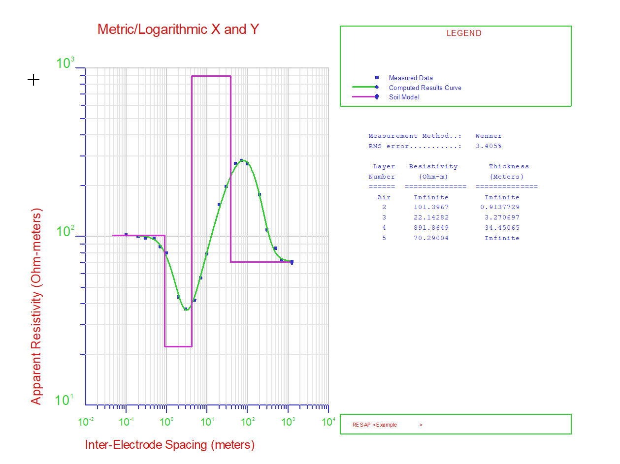
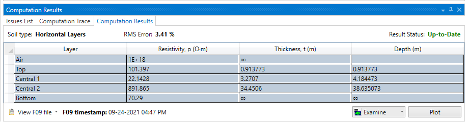
Resulting soil structure from a RESAP analysis.
In addition, RESAP can be used to approximate the real earth structure using a simplified model based on a reduced number of layers specified by the user. It can also be used to generate limiting soil models, e.g. to ensure that safety requirements are met with a conservative margin despite the fact that the soil structure model exhibits local variations (multiple soil models within the geographical area of interest).
Technical Highlights
With RESAP, you can develop four fundamental types of soil models:
Technical Features
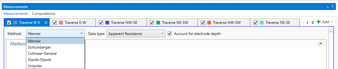
- Input soil resistivity data for multiple traverses and obtained from Wenner, Schlumberger, Dipole-Dipole or Unipolar methods, or specify your own arbitrary arrangement (General method). Continuously vary the ratio of current probe spacing to potential probe spacing (e.g. a traverse may start as a Wenner – but finish as a Schlumberger configuration).
- Plot the data choosing a more physically relevant x-axis based on the median probing depth of the array configuration.
- Data can be specified in the system of units of your choice (metric or imperial) and consistent with your instrumentation (i.e. apparent resistance or apparent resistivity).
-
Optionally specify the depth of the current and potential probes, for additional accuracy (this is especially beneficial for smaller electrode spacings).
Electrode arrangements supported by the application. Probe depths can also be accounted for. -
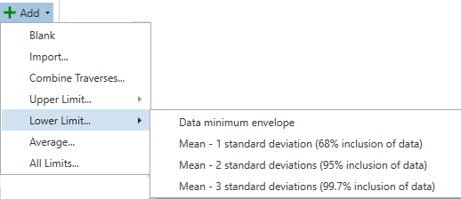
Easily construct limiting soil models by combining data from multiple traverses (Upper, Lower, Average, or any arbitrary data selection). Possibility of creating limiting soil models (Upper Limit and Lower Limit) based on envelopes of the data as well as based on the standard deviation of the data at each spacing. In this way, cover all possible scenarios, and ensure the subsequent grounding analysis is conservative.
Creation of additional analysis scenarios by combining data from different traverses. - Identify additional equivalent soil structures by guiding the convergence process with varying initial estimates, and conservatively base your grounding system design on a soil structure corresponding to a worst-case scenario that accounts for seasonal variations.
- Use the visualization tools to plot the initial soil model and the computed apparent resistivity curve alongside the measured data for a fully specified initial estimate of the soil model.
- Use plot interactivity to optimize initial estimates and obtain high-quality fits, quicker.
-
Use the locking feature to have the program calculate a soil model incorporating, partially or totally, the horizontal layer characteristics that you have specified.

Specification of starting and constrained values for the parameter optimization process. - Choose between three powerful least-square optimization algorithms (Steepest-Descent, Levenberg-Marquardt, or Simulated Annealing).
- Control the process by customizing the iteration parameters and stop conditions.
- The high-precision digital filter ensures apparent soil resistivities are computed quickly and accurately.